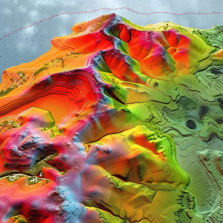
Our technical team has the capability to create 3D digital models of geological features by employing drones.
With support from the Tevi program, EV Tech secured funding for a drone survey in collaboration with 3DeepMedia to map and model significant geological faults where they emerge.
The objective is to explore the potential hosting of lithium-enriched geothermal waters at depth within these faults. Precise mapping of the surface manifestation of these faults is crucial for a comprehensive understanding of the subsurface conditions related to our exploration targets. The utilization of remote sensing technologies, such as drones, allows us to acquire high-resolution imagery safely and efficiently, facilitating interpretation using specialized software back at the office.
The photogrammetric data captured during the drone survey was utilized to construct a 3D digital model rendering of the landscape. From these geolocated digital models, crucial structural data can be extracted, providing a detailed overview of the surface fracture regime, which can then be extrapolated to the subsurface. Additionally, funding was allocated for geological analysis of these structures, fostering collaboration between EV Tech and experts to enhance our understanding and interpretation of the models.